miércoles, 14 de noviembre de 2012

On the Hilltop and Down By the River - Archaeology Magazine


On the Hilltop and Down By the River 

Archaeologists search for the roots of southern Indian cities at the site of Kadabakele

[image]

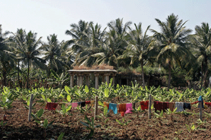
View from the hilltop site, with the village of Kadabakele below, beside an expanse of rice paddies

Letter from India: Living Heritage at Risk
Letter from India:
Living Heritage at Risk

Slideshow: Exploring HampiSlideshow: Exploring Hampi

Oceans of DharmaOceans of Dharma

India's Village of the DeadIndia's Village of the Dead


[image]

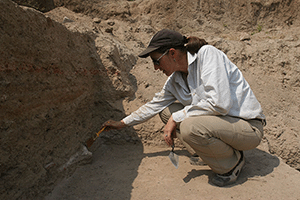
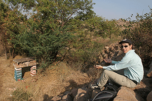
Kathleen Morrison of the University of Chicago at the excavation of an Iron Age domestic site

[image]

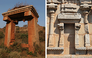
One of the two dig sites on top of the hill at Kadabakele contains mysterious megalithic features

[image]

View from the hills that surround the saddle, with both excavation pits

[image]

Residents of the village have become indispensable crew members.

[image]

Kathleen Morrison discusses a find with graduate student Mudit Travedi.

[image]

Kathleen Morrison and graduate student Andrew Bauer of the University of Chicago at the excavation of an Iron Age domestic site

[image]

Kathleen Morrison leads the way down from the hillgirt valley to the river terrace portion of the site. The stepped hole at center was the result of the illegal construction of a reservoir.

[image]

The illegal reservoir, looking up to the saddle where the rest of the site is located

[image]

Kathleen Morrison and her students make the best of a bad situation by cleaning up the wall of the illegal pit to get a profile of deep Early Historic deposits.

[image]

Graduate students work cleaning up a section of the wall of an illegal pit to get a profile of deep Early Historic deposits.

[image]

A ruined 10th- to 11th-century temple sits in the middle of the river terrace, providing an indication of how expansive the Early Historic city was

[image]

A hero stone was found on the river terrace. Common in the early Medieval period, they commemorate death in battle or fights with wild animals.

[image]

The grad students and local excavation crew hike in to the river terrace site. A Middle Period defensive wall is visible in the background.

[image]

A total station is used to ensure that the salvage excavation in the illegal pit can become part of the team's larger data set on the large settlement.

The rice paddies north of the Tungabhadra River in India's state of Karnataka have just been planted. Eventually the shoots will grow tall and then slump under the weight of their heavy panicles, but for now they're a tender green stubble. Massive yellow-and-pink granite boulders in some of the paddies look like surfacing whales or elephants lolling in mud on a steamy morning.

I'm riding through this patchwork of ponds and embankments with University of Chicago anthropologist Kathleen Morrison and her excavation team. It takes about an hour to get from the local city, Hospet, to Kadabakele, the village where they are working on their third excavation season. Hospet is the main tourist hub for the extensive ruins of the 14th- to 16th-century metropolis called Vijayanagara or Hampi, which ruled an empire encompassing most of southern India. Morrison has spent decades studying the city and the surrounding region ("Oceans of Dharma," September/October 2009), but today we're skirting the city's temples and royal residences to understand better what was here before.

We pull up to the small, tidy village of Kadabakele (a corruption of "last gate" in Kannada, the language of the region), sandwiched between the road and a steep hill of giant boulders. The village has provided Morrison and her team with a dedicated crew. All the residents are now stewards of the site, also called Kadabakele, and several have become adept excavators. After a discussion about whose turn it is to carry the trunk up, the grad students and crew members grab armloads of equipment and head up a steep, rocky path. The villager with the trunk on his back leads the way in a dead sprint.

Morrison's previous work in the Vijayanagara region was spread across a broad area. She conducted landscape-level studies to understand how the old city altered the area around it, particularly how it manipulated water to provide for an urban population that was one of the largest in Asia. But this project has a different nature. Rather than going wide, here Morrison is going deep, exploring a long history of use and reuse that covers 3,000 years.

Morrison and I bring up the rear of the column. She stops every minute or two to talk about the site with grand enthusiasm as we make our way up. It's hard to tell from the climb exactly where they could be digging up there, as the top of the hill looks like a pile of boulders the size of starter homes. We pass between some of them and around a corner, and the top of the hill opens up into a flat, hill-girt valley, a six-acre saddle hemmed in by two stories of rock that bounce sound around with a pleasant reverberation. Morrison and Carla Sinopoli, her longtime collaborator from the University of Michigan, identified this hilltop as an important site in 1996 and 1997, during their decade-long assessment of the region, the Vijayanagara Metropolitan Survey. For centuries and centuries, before the rise of the Vijaynagara Empire, people lived up in towns dotted along hills up and down the river. Kadabakele might have been the biggest.

The old orthodoxy, Morrison tells me, was that the Vijayanagara Empire had moved into a largely unpopulated region when the large city was established in the 14th century. Habitation sites of these Iron Age (1000-300 B.C.) and Early Historic (300 B.C.-A.D. 500) peoples had not been found or studied. But the survey, and the depth and complexity of Kadabakele, show that there were dense settlements and sophisticated cultures thriving here before the city rose. And they had some rather mysterious megalithic tendencies that Morrison and Sinopoli (who was not on this trip) are trying to understand.

The team has already started working for the morning as Morrison shows me around. The grad students and villagers here are working in two plots on the western side of the saddle. Down the other side of the hill, students who were in a second car have skirted the hill and hiked into a third excavation area, on a wide flood terrace hemmed in by granite and river.

The sites, up here and on the terrace below, provide the kind of long, unbroken history that makes archaeologists light-headed, and Morrison's excitement as we move from plot to plot is palpable. Here, rather than taking an exhausting, region-scale view, she can settle in and explore deeply the history of one community, in one place, over centuries, to understand the social, economic, and technical evolution of southern Indian cities. The area is also interesting regionally, as it lies along the path of long distance exchange between the northern and southern parts of the country. This is one of the first digs of a settlement site from the period, so just about everything that comes out of the ground is new. And a lot is coming out of the ground.

At the northern plot, out under the intensifying sun, the team, led here by University of Chicago grad student Andrew Bauer, are working through a complicated home site that dates back to the Iron Age. The residents regularly replastered their floors, making for slow-going excavation. As the plaster comes up and the details of the small dwelling start to come into focus, the archaeologists are building a picture of the lives of the site's villagers. They have found three levels of Iron Age occupation, dating back to around 800 B.C., with a smaller rectangular house overlaid on top of a larger round structure that may have burned down. "It just keeps going and going," Morrison says, marveling at the complexity of the site. When the successive layers are excavated completely and analyzed, Morrison and Sinopoli hope see how social and economic inequality, which was emerging at the time, evolved and affected everyday lives. In addition to scores of pottery sherds, the team has also found evidence of complex metallurgy for iron and steel tools and fasteners.

Bauer shows me around another excavation pit from earlier in the season. The area on top of the hill has a natural depression where water accumulates in a seasonal pool. It is dry now, and Morrison's team has dug a 12-foot-deep trench through the sediment. Lab tests, including carbon isotope studies, pollen analysis, and soil chemistry, on samples from this pit will fill in another time sequence to explain the evolution of the community--how the people there altered the water, sediment, and vegetation regimes around the time that rice cultivation spread into the area. The manipulation of these resources also provides information on the emergence of social stratification, which would become a dominant theme in the later Vijayanagara period, when royals and cultural elites made decisions that altered the whole region and built the stone buildings that today draw tourists and hippies from all over the world.

South of the first pit and thankfully in the shade a wall of boulders, another part of the team, led by Mudit Travedi, who is originally from New Delhi but is now a student of Morrison's in Chicago, works on a considerably more puzzling site--a series of odd megalithic structures. Morrison cautions me against sitting on a rock pile next to the plot. "We're up to a three-scorpion count on this unit," she says, and this is one of their preferred haunts. I gingerly take a seat on a stump next to it while Morrison hops in the shallow pit with a trowel. She's just as enthusiastic mixing it up in the dirt as she is when explaining the dig's larger questions. "Every time I walk around, I try to see one new thing," she says.

In this unit there are odd alignments of stones that form circles with little tails: "lollipops," Morrison calls them. The interesting thing about the lollipops is that they run deep. The alignments were maintained over hundreds of years as new stones were added to them. They drift in shape rather randomly, but appear consistently throughout the layers. Sometimes the interiors of the lollipops are filled with broken pottery and bone fragments. No human remains have been found, but Morrison theorizes that these small megalithic structures are some kind of memorials that were revisited continually for centuries, from 800 B.C. to the rise of Vijayanagara. Mysteries on mysteries keep turning up here. In one case, they found a floor surface above one of the lollipops, leading them to assume that it was not associated with a burial. And yet just at the end of the season, they reached the top of what appears to be a burial pit. More information on the purpose and usage of these small megaliths will have to wait until the next season.

At the end of the Iron Age and the beginning of the Early Historic period, the population of the town moved down the side of the hill to the river terrace. But they continued to maintain the lollipops, which by then may have become shrines to the community's ancestral home on top of the hill. "People have kind of turned the whole outcrop into an artifact," she says, referring to the rock alignments, and paintings and pocked designs on some of the surrounding boulders.

Morrison takes me to the south side of the hill so we can descend to the river terrace excavation below. The most obvious feature on the broad, flat plain is a ruined and overgrown 10th- to 11th-century temple right in the center--an indication of how large this town grew before the rise of Vijayanagara. It probably encompassed the entire terrace, which covers more than 90 acres, turning the entire plain into an archaeological site. But upon further examination of the terrace from the top of the hill, it's clear that something is wrong. At the base of the hill, directly where Morrison and I are headed, it looks like someone has tried to dig an Olympic-size swimming pool. The great stepped pit down there is an archaeological catastrophe that Morrison only discovered at the beginning of the season, just a month before my arrival.

As we make our way to the bottom--there's no real path, but we're both spry enough to handle it--Morrison fills in the blanks. Some time since their last field season at the site in 2005, someone illegally brought in construction equipment and dug out this giant pit, apparently to create a reservoir to capture runoff coming down the hill. This is, for Morrison, bitterly ironic, as she spent years studying Vijayanagara-period reservoirs south of the river. "I do think it is a little bit funny [but not funny ha-ha, methinks] that it's the building of a reservoir that's causing all these problems," she says. "I finished studying reservoirs and now they're coming back to haunt me." Locals say that the village council of nearby Anegondi authorized the project, even though the land is protected as part of the greater Vijayanagara area. One might expect that the reservoir was dug with the idea of extending rice paddies (just like on an adjacent terrace) across the archaeologically rich terrace, which would destroy any trace that people ever lived there.

And upon actually arriving at the bottom, I can see just how horrible this intrusion was. The pit is 90 feet long, 65 feet wide, and up to 15 feet deep. The spoils piles from the illegal digging, which sit around the pit in a sloppy ring, are as much ceramics as dirt. "I've never see so much Russet-Coated Painted Ware in one place," says Morrison, surveying the damage. The piles are gray with ash from domestic hearths and studded with large blocks from Medieval foundations. The illegal pit ripped through scores of cultural layers, indicating both how rich the archaeology of the river terrace is and how much there is to lose. "I haven't seen a lot of looting, so for me this is as bad as it gets," Morrison says.

Morrison has submitted reports urging the archaeological authorities to take some kind of action. In the meantime, she has two grad students and a couple of villagers trying to make the best of a bad situation. "The loss of information here is just sickening," she says. "But we are going to get a really beautiful profile." They're cleaning up one side of the pit to create straight vertical cuts, and then digging a little deeper below it to find the earliest archaeological layers. A simple glance at the clean, straight areas they have uncovered confirms how much was wasted when a bulldozer or backhoe came through . There are several thick domestic levels--roofing tiles, brick, ash, bones, countless pottery sherds, layers of plaster and burnt material--just sticking out of the wall. Just where the record ends on top of the hill, it begins down here, and they have found clear evidence of the social differentiation they are trying to track up top. The roof tiles, for example, were a sign of social distinction and wealth at the time. Further comparisons with the saddle should provide a clear record of how that social stratification evolved in early south Indian cities. This social, political, and economic record will be key to understanding the context in which the capital of the Vijayanagara Empire was established.

The entire site is a vast repository of the area's history that represents an unbroken chain of settlement and daily life stretching back around 2,500 years before Vijayanagara. What's already been lost here is astounding, but Morrison and her team will get some information from it that will demonstrate just how rich, complex, and worth protecting the area is.

According to Morrison, this is one of the earliest large towns in the region, or largest early towns, depending on which superlative one prefers. It is huge, deep, and, with one obvious exception, largely untouched, with superb preservation of plant and animal remains. It will tell Morrison and Sinopoli the story of the rise of urbanism in south India, a subject about which little was known until now. "It could be one of those sites, like in the Near East or Egypt, where generations continue to excavate," Morrison says. Scanning out across the river terrace from one of the illegal spoil piles, I can see her point. If the entire terrace has this depth and complexity, Kadabakele could represent the work of several lifetimes.

Samir S. Patel is a senior editor at ARCHAEOLOGY.


Share Article


CldiPad

India's Village of the Dead - Archaeology Magazine


India's Village of the Dead

An exclusive look at a little-known Iron Age cemetery

There's no clear path to Hire Benakal in the hills north of the Tungabhadra River in the southern Indian state of Karnataka. If you have to double back only two or three times on the way, you've done well. University of Chicago anthropology graduate student Andrew Bauer leads me through the thorns and boulders until we emerge on a high plain surrounded by ridges. He points out knee-high aligned stones and propped-up slabs that mark the edges of the site. As we navigate through it, we walk around a pile of house-sized boulders, and the massive scale of Hire Benakal, like a city skyline in the distance, becomes apparent.

On a gentle slope are scores of dolmens (megalithic tombs) resembling houses of cards—if playing cards were slabs of granite 10 feet tall and weighed 10 tons or more. The monuments were built over more than 1,000 years spanning the southern Indian Iron Age (1200-500 B.C.) and Early Historic (500 B.C.-A.D. 500) periods, and there are more than 1,000 of them across nearly 50 acres, from modest rock enclosures to mausoleum-like tombs.

Historical sources are vague, but Hire Benakal's existence may have been documented as early as the 1850s, and the site was first examined in detail by historian A. Sundara of Karnatak University in the 1960s. In 2007, Bauer conducted the first systematic survey of the site and its environs. It was long thought that the Iron Age people of India were nomadic, making a megalithic site such as Hire Benakal difficult to explain. But recent surveys, including Bauer's, have turned up many settlements, including two within a mile of Hire Benakal, that show the people lived in villages and practiced agriculture and pastoralism. "The site appears to be a principal center of culture in the region," says Sundara.

Though visiting the site today is an eerie experience—akin to walking through a ghost town of stone—Bauer has concluded that Hire Benakal was more than just an isolated cemetery; it was also a part of an active landscape, and a place where social status and inequality first began to develop. "We really understand the site much more in context now, because I surveyed all around it," he says. It was important socially and is absolutely overwhelming to the eye. If it were not so remote, Hire Benakal might be a national treasure.

Samir S. Patel is a senior editor at ARCHAEOLOGY.

Letter from India: Living Heritage at Risk
Letter from India:
Living Heritage at Risk

Slideshow: Exploring HampiSlideshow: Exploring Hampi

Oceans of DharmaOceans of Dharma

On the Hilltop and Down By the River
On the Hilltop and
Down By the River


Share Article

Samir S. Patel is a senior editor at ARCHAEOLOGY.


Share Article


CldiPad

Oceans of Dharma - Archaeology Magazine


Oceans of Dharma

Can investigating India's medieval dams provide a model for bringing water to a billion people?

While Kathleen Morrison, an anthropologist from the University of Chicago, answers her phone, I have a moment to take in the stunning view from the top of Matanga Hill. There are dozens of other hills like this one, piles of smooth granite boulders that resemble oversized river cobbles. Lush paddies and fields of bananas and sugarcane lap against them. This, according to legend, was the forest domain of the monkeys, home of monkey-god Hanuman, in the ancient Sanskrit epic The Ramayana. Through a midday haze that gives everything a painterly quality, it's also clear that the landscape is studded with buildings—the ruins known as Vijayanagara (also called Hampi, the name of a modern village here). Today, the site in the Indian state of Karnataka is crawling with pilgrims, tourists, and neo-hippies. But it was once the sprawling, wealthy capital of an empire that ruled most of southern India from the 14th to 16th century, during a time called the Middle Period, when the subcontinent was a hodgepodge of shifting empires, sultanates, and kingdoms. The rulers here had a sense of the monumental—there are temple complexes, columned bazaars, palaces, baths, and elephant stables, in addition to irrigation canals from the braided channels of the Tungabhadra River. From up here, it seems like a fine place to have a big city.

"This is a really tricky place to have a big city," Morrison had told me a few minutes before. Beyond the reach of the canals, this is one of the drier parts of southern India. As in many ancient cities—Petra and Angkor come to mind—water played a critical role in Vijayanagara's political and physical landscapes. On the horizon two miles away is the vegetation-choked, 14th-century Kamalapura Reservoir, which provided water for several hundred thousand people. I try to imagine the groves it now irrigates as a dense metropolis.

Morrison hangs up the phone. The call was from her team, excavating a site across the river. Their Hindustan Ambassador—India's classically boxy sedan—has broken down. We have the other car, so it's time to go.

Prior to this dig, Morrison's historical, archaeological, and paleoenvironmental research focused on a landscape-wide study of the reservoirs that served Vijayanagara. She found that the old waterworks have a surprising significance for a thirsty nation (70 percent of its 1.1 billion people rely on irrigation-supported agriculture) grappling with disruptive megadams and dwindling groundwater.

The idea that past or indigenous cultures employed some kind of forgotten wisdom in managing their resources is a common theme in Indian development literature. "New traditionalism," as the approach is known, posits that large, state-run projects such as big dams are inferior to traditional forms of water management, which are described as community-run, small-scale, sustainable, and fair in their distribution of water. It is an admirable vision, but what happens when, as Morrison found, the wisdom of the past isn't quite what we would like it to be?

Morrison, trim and tireless, began working here as a graduate student in 1985, mapping temples and royal structures. Her interests in agriculture and non-elite populations drew her to the city's periphery, where she collaborated with Carla Sinopoli, now at the University of Michigan. They have worked together for 20 years and codirected the decadelong Vijayanagara Metropolitan Survey, the first comprehensive study of the region. Despite long days spent walking the landscape, it sounded like a real adventure—dodging tree snakes in thick banana groves and stumbling upon overgrown, undocumented 15th-century temples. Among other finds, including Early Historic sites along the river (her current excavation site among them), they saw evidence of a boom in construction and population in the early 16th century, not long before the Hindu city was attacked by northern sultanates and abandoned in 1565. "I figured there must have been a process of intensification of agriculture, an increased demand for food," says Morrison. This would require land and water beyond the urban core, such as in the dusty Daroji Valley, about 10 miles to the south. There, she documented the remains of hundreds of dams and reservoirs, from small tanks to valley-spanning berms. "The reservoirs are certainly relevant to larger questions," says Sinopoli, such as how the city related socially and economically to the countryside.

Morrison is a bit of a polymath. "I pretty much just wind up and go," she tells me, as if in warning. She digresses at times into talking about birdwatching, the history of rice, isotope analysis, and the politics of large dams. The latter subject fit well with her study of agriculture, and she saw a way to contribute an ancient perspective on a modern debate.

India has particular water challenges. Rainfall and surface water are distributed unevenly across the country, and 80 percent of its rain comes in just 100 days of monsoon, making the water difficult to store, maintain, and use. Since independence in 1947, India has welcomed gargantuan river-diverting dam projects. In 1954, at the opening of the Bhakra Nangal Dam in Himachal Pradesh, India's first prime minister, Jawaharlal Nehru, is reported to have said, "These are the new temples of India where I worship," a bold statement in a country where the temple and mosque loom large. I see a slightly bastardized and oft-quoted version of his statement—"Dams are Modern temples of India"—on a wooden sign at the Tungabhadra Dam, alongside other prescriptive aphorisms, such as "Conserve water, conserve civilization" and "For each evil act of man, pain follows like a wheel." This dam, completed in the 1950s, is just 10 miles from Vijayanagara. Despite the wonders of the city ruins, the dam attracts just as many Indian tourists—it is a monument of a contentious secular religion.

Such dams were once symbols of a powerful, independent India, examples of the way a modern state could marshal its resources to improve the lives of its people. "There was a spectacular political dimension to this, making evident the fact that the nation has arrived, that it is truly the equal of the West," says Dan Klingensmith, a historian of modern India at Maryville College in Tennessee. That vision has been tarnished, in large part because of a fevered protest movement against the Narmada Valley Development Project, a system of 3,200 small, medium, and large dams across 750 miles of the Narmada River, including the $450-million Sardar Sarovar megadam. "Big dams are to a nation's 'development' what nuclear bombs are to its military arsenal. They're both weapons of mass destruction," wrote novelist and activist Arundhati Roy in a 1999 essay attacking the project.

Vijayanagara structure

Many Vijayanagara structures are scattered across an agricultural landscape, some of which is still irrigated by 500-year-old canals and reservoirs. The city's waterworks might provide perspective on modern water management.
(Samir S. Patel)

Tungabhadra Dam

The Tungabhadra Dam, completed in the 1950s, is merely the latest large resource-management project in the Vijayanagara region. Massive waterworks were also common hundreds of years ago.
(Samir S. Patel)

Anthropologist Kathleen Morrison

Anthropologist Kathleen Morrison, examining a non-elite Middle Period site, has spent decades studying the region around Vijayanagara's urban core, in part to understand how the city's rulers met the agricultural needs of one of the largest cities in Asia.
(Samir S. Patel)

Modern megadams are criticized for damaging the environment, displacing and dispossessing the poor, and not fulfilling their stated goals. Though the government says the Narmada Project will supply 20 to 40 million people, it will displace hundreds of thousands in one state for the benefit of those in another, and will inundate thousands of acres of forests and fields. These problems, coupled with nostalgia for the purity and simplicity of village life—no surprise in the nation of Mahatma Gandhi—made a compelling case for a return to some kind of traditional water systems. This new traditionalist idea appeals to a number of groups: hard-core nationalists, environmentalists, social reformers, and small-government advocates.

"We need to solve water and energy problems in India today. Even people violently opposed to big dams recognize that," says Morrison. "So how do you get that? If the argument is to revive old systems, we better understand them."

The Delhi-based Centre for Science and the Environment, an advocacy organization, has documented traditional systems of rainwater harvesting, which are touted as more efficient, sustainable, and democratic. David Mosse, a social anthropologist at the University of London, has approached such claims critically. Using the work of local historians, administrative records, and oral histories in Tamil Nadu, he found no evidence that indigenous methods were fair, equitable, or democratic. Rather, the building of an ancient reservoir was an act of statecraft and power. New traditionalist rhetoric is a vision of the past imprinted with modern desires, he suggests. We're seeing what we want to see.

"Some scholars and activists romanticize what happened in earlier eras, almost suggesting that social relations before capitalism and colonialism were more socially and ecologically harmonious. None of this is based on any close examination of social relations," says Amita Baviskar, an environmental researcher at the Institute of Economic Growth in Delhi.

Morrison's study of the Daroji Valley brings the landscape and reservoirs to bear on the question of whether traditional systems were more equitable, or even smaller or more sustainable than what we have today. If they are not, do such myths about the past help or hinder plans for the future?

"I really like her interest in trying to evaluate some of these claims with evidence other than the often very florid rhetoric that surrounds them in public discussion," says Klingensmith. "She's actually using archaeology."

U.V. Sriniwas has driven Morrison around Karnataka for decades, since she was 21. She calls him "the premier archaeological driver in Hampi," and they share a kind of private geography of reservoirs and other sites. He's at the wheel for a spin through the Daroji Valley.

"Things just went nuts in the 16th century," Morrison says. Migration swelled the population of Vijayanagara beyond the capacity of canal-fed fields and paddies, pushing agriculture into marginal areas, such as Daroji. The surveys showed that in the early 16th century, there was an explosion in the construction of reservoirs, which cascaded through this and other valleys, one into another. At the time, nearly half the land was dedicated to reservoirs or the fields they irrigated.

Our first stop is perhaps the greatest folly of the 16th century, Rayakere Dam. Sriniwas follows National Highway 13 as it climbs across the dam's spine to a makeshift truck stop for the overstuffed lorries that roar across India's highways. Visiting Portuguese horse trader Domingo Paes wrote in the 1520s of the construction of what was likely this dam: "In the [basin] I saw so many people at work that there must have been fifteen or twenty thousand men, looking like ants, so that you could not see the ground on which they walked." It was 91 feet high, 130 feet thick, and more than half a mile long, faced with blocks of red stone. The notion that precolonial waterworks were small and community-run flies away like my hat in the wake of a passing truck. "They were definitely pushing the limits of what was possible," Morrison shouts before we clamber down to the calm of a field below. Not only was this dam massive, it never even held water, likely because the ground was too porous. It's a valley-spanning indictment of "traditional" water management. Morrison's analyses of Daroji's pollen, siltation, and landscape changes show that many Vijayanagara-era reservoirs, including the smaller ones often championed today, were unreliable and unsustainable. They were likely to fail, experienced siltation, and were subject to heavy evaporation.

sluice gates

This sluice gate from the failed Rayakere Dam (left) features a carving of the Hindu god Ganesha and mimics formal temple architecture and a sculptural form called an aedicule (right, from Vijayanagara's Krishna Temple) that itself represents a temple. Morrison theorizes these gates were meant to be temples dedicated to worship of a reservoir.
(Samir S. Patel)

reservoir fertility shrine

Deep in the Daroji Valley, Morrison has documented the remains of hundreds of old dams, including the valley-spanning berm of the 16th-century Dharmasagar Reservoir. Such works, some of which rival modern dams in environmental and social disruption, suggest there was no "golden age" of community-run water management in southern India. The sluice gates of the reservoir are still sites of worship today. This one is likely a fertility shrine.
(Samir S. Patel)

As Sriniwas guides the Ambassador through the valley, Morrison points out small, dry, silted-in reservoirs here and there. We stop at the place where, in Morrison and Sriniwas's private geography, their car caught fire and Sriniwas burned his hand: the Dharmasagar ("ocean of dharma") Reservoir. Not as tall but more than twice as long as Rayakere, Dharmasagar was a seasonal, valley-wide reservoir. Morrison located the dam's founding inscription on a slab among piles of thorny branches used as fences to keep goats from wandering off—the dam was created not by a village, but by a group of merchants. Religious and literary texts confirm what the inscription and the scale of these projects suggest, that India's traditional reservoirs were not just for communities. Merchants, village big men, regional politicos, and royalty all built them for political and religious favor. Large and small alike, they were used to control water to enforce social hierarchies, such as gender and caste, according to Mosse.

"The whole social structure of inequality is built around irrigation," says David Ludden, a historian of Indian development at New York University. Differential access to water is like an engine of inequity, stratifying populations by access and privilege. While some were displaced and dispossessed, those with access to water could grow luxury crops, such as rice and fruit, and institute a cash economy that further marginalized others. Dharmasagar also shows how directly damaging such works can be. The 20-foot-tall earthen wall has several chasms cut through it. "These breaches weren't necessarily just agricultural disasters," Morrison says as I pull thorns out of my shoes. "People would have died."

A breach at the two-mile-long dam at the end of the valley, which forms the still-in-use Daroji Reservoir, wiped out several villages in 1851. It's hard not to see such massive structures as just as huge, intrusive, and risky as modern dams, with similar benefits and negative social and environmental effects. The Vijayanagara Period hardly looks different from today.

"Virtually all of the flaws of the larger, modern projects can also be laid at the feet of 'traditional' reservoir irrigation in southern India," Morrison wrote in a paper she has presented at academic meetings. There was no golden age of environmental stability, egalitarian social relations, and community self-governance to restore.

India has always been enamored of its dams. Building a reservoir is listed in inscriptions alongside having a son and planting a forest as great meritorious acts. Patrons bragged about their reservoirs, which were much-discussed as political and social strategies. Morrison's work in Karnataka provides a glimpse as to why—then as now—dams and reservoirs play a disproportionate role in the Indian political imagination.

Each big reservoir we visit has sluice gates, offshore stone towers used to control the flow of water through dams and into fields below. The typical 14th- to 16th-century sluice gate consists of vertical stone slabs linked by crossbars, with a three-part molding sequence across the top, usually carved with gods or goddesses, uncannily mimicking temple architecture. As we appreciate a substantial example featuring the likeness of elephant-headed god Ganesha in the field below Rayakere Dam, Morrison says, "The sluice gates evoke temples, but they're in a sense meant to be temples."

The gates are shaped like doorways to temple sanctuaries, which are usually adorned with the same iconography —Ganesha, the goddess Lakshmi, or donor portraits. In the Virupaksha Temple complex in the urban core of Vijayanagara, Morrison points out a motif repeated on several sculptural walls—it looks exactly like a sluice gate. Called an aedicule, it is thought to stand in symbolically for other complete temples. Hindu temples also often have aquatic motifs, such as turtles and fish, on their outer walls to evoke the mythological ocean of life that surrounds the world. Sluice gates, Morrison theorizes, may be temples or gateways dedicated to productivity, prosperity, and worship of the reservoir—itself a symbolic ocean of life. I recall Nehru's quote and Morrison is one step ahead of me: "They were temples then, too."

The still-standing gates continue to hold religious importance. Some of them, at Dharmasagar, for example, seem curiously alive. Painted or with colorful cloth tied to them, they are fertility shrines, sites of active worship.

stepped tank

Vitthala Temple complex

Vitthala Temple complex

The glories of the city of Vijayanagara include the stepped tank (with stone aqueduct at rear) in the royal center and the Vitthala Temple complex. Its magnificent courtly and sacred districts would not have been possible without the city's large, extensive water system.
(Samir S. Patel)

Most serious people in the development arena separate religion from water management and understand the flaws of traditional systems. "I do not think it is anybody's case that we need to replicate the techniques and management systems of the old ages," says Himanshu Thakkar of the South Asia Network on Dams, Rivers, and People. "But what made it possible for the traditional systems to survive so long can provide useful pointers for our current situation." He proposes a multipronged approach including traditional rainwater harvesting, watershed development, and cropping patterns, combined with transparency to give people a say in resource management.

According to Ludden, new forms of social organization, separated from gender, caste, and wealth, must be a part of new schemes, even if they borrow other features from the past. "It's not like you can make the local community today like it used to be," he says. "You wouldn't want to. We need a more egalitarian community, which there never was."

We need options, this suggests, without historical precedent. Yet the unqualified new traditionalist idea persists, with an outsized role in the public debate on dams and water management. "Even while this narrative loses academic credibility it is still found to pervade the everyday thinking and policy-making of many environmental activists, NGOs, development practitioners, journalists, and other shapers of public opinion," writes Mosse.

Does a false vision of a mythical, utopian past affect the search for alternatives to megadams? The new traditionalist discourse is a rallying point for those sympathetic to both environmental and social causes. "One could argue that this is not a harmful myth, and one should be more tolerant of it. Some societies need their myths as much as they need history," says Baviskar. "There has to be room for both." Yet she also sees the merit in Morrison's perspective: "It's a valuable exercise because so many claims are based on assumptions, so it's good to know that some of them are not so."

There is a potential for harm in a naive view of the past. It can be manipulated to legitimize any model of development, says Mosse. It denies histories of inequality and suffering on the part of women and those of lower caste. And it can contribute to a failure of the imagination, diverting state support from innovative schemes, ignoring higher population densities, or damaging the credibility of the antidam movement. Furthermore, the emphasis on traditional methods could take attention and funds away from other projects, such as those addressing losses and inefficiencies in modern dam systems or dealing with unmanaged groundwater extraction.

"The social worlds today are so different from yesterday that I don't know if we want to or can go back to them," says Morrison. "That just means you have to be a little realistic about the problems of the old ways."

The temptation to take a romantic view of the past is strong in Vijayanagara. It's a potent combination of intoxicating landscape and the heady pomp of courtly architecture. It's a pleasure to live in that myth for a few languid days, but we can't count on that feeling to supply the needs of a modern nation. Just because it's old doesn't mean it's wise. n

Samir S. Patel is a senior editor at ARCHAEOLOGY.


Share Article


CldiPad

Tutankhamun: Anatomy of an Excavation | The Griffith Institute

Tutankhamun: Anatomy of an Excavation

Tutankhamun: Anatomy of an Excavation is the definitive archaeological record for Howard Carter and Lord Carnarvon's discovery of the tomb of Tutankhamun.

On November 5th 1922, Howard Carter wrote in his pocket diary: 'Discovered tomb under tomb of Ramsses VI investigated same & found seals intact.' The subsequent excavation of the tomb of Tutankhamun captured the public imagination. The complete records were deposited in the Griffith Institute Archive shortly after Carter's death.

Our aim in publishing this material online is to provide an essential resource for scholars, school children and interested adults alike. This demanding project has taken 15 years and has been directed by the Keeper of the Archive, Dr Jaromir Malek.

Carter's unique numbering system provides the framework on which the database is constructed. Each object, ranging from the outermost shrine (one of four which surrounded Tutankhamun's mummy; 207-01) to the smallest fragment of red ochre found on the floor of the tomb (620-83), was given its own number. Carter then recorded the position, size and appearance of the object, supplemented by his detailed drawings.

The other members of the excavation team included Arthur Mace who shared the work with Carter for the first two seasons. He was primarily responsible for the excavation diaries and entries on object cards. Alfred Lucas compiled the notes on conservation and Alan Gardiner copied the hieroglyphic inscriptions which form part of the card catalogue.

Harry Burton was the only photographer permitted to work in the tomb. Burton's iconic photographs captured the story of the excavation as it unfolded, creating not only beautiful images, but an invaluable record of archaeological context. Our carefully chosen selection of Harry Burton's photographs may be ordered from the Griffith Institute's print on demand website.


CldiPad

domingo, 4 de noviembre de 2012

La Calzada romana de La Fuenfría (Madrid)


[foto de la noticia]
Datos básicos
Situación. Valle de La Fuenfría, Cercedilla.
Cómo llegar. Desde Madrid, por la A-6 hasta Guadarrama. Continuar por la M-622 hasta Cercedilla. Entrar a la población por el túnel bajo el ferrocaril, en las cercanías de la estación.
Distancia. 60 kilómetros desde Madrid.
Accesos. En Cercedilla y cien metros enfrente de la estación se inicia la carretera de las Dehesas. Seguirla hasta el kilómetro 2 donde está el Centro Valle de La Fuenfría, donde comienza la marcha.
Recorrido. Ruta lineal con salida y llegada en el mismo punto.
Información. Centro de Educación Valle de La Fuenfría. Tel: 918 522 213 y www.pueblos-net.com/cercedilla.
    La calzada romana de la Fuenfría es uno de los más singulares entre todos ellos, pues a su indudable valor histórico e incluso arqueológico, se suman los naturales de los enclaves por los que se extiende: el valle de la Fuenfría, en la Sierra de Guadarrama, primer espacio natural madrileño destinado a convertirse algún día en parque nacional.
    La Vía XXIV de Antonino, su nombre oficial, es una de las calzadas romanas más importantes de cuantas se conservan en la península Ibérica, tras la Vía de la Plata y la Vía Augusta. Catalogada en 1981 de Bien de Interés Cultural por el Gobierno madrileño, su recorrido es un agradable paseo. Nada difícil, tiene una longitud de once kilómetros, siempre por terreno tendido y señalizado.

Trazado recuperado 

    El Centro de Educación Ambiental Valle de la Fuenfría, donde ofrecen información de ésta y otras excursiones por la zona, es el mejor lugar para comenzar la marcha. Unos metros más arriba del mismo, surge un camino a la izquierda que rumbo Norte, discurre más o menos paralelo a la carretera.
    En una zona donde el pinar se aclara aparece el primer tramo de la calzada. Perfectamente rehabilitado no alcanza los cien metros, pero da una idea precisa de como eran aquellas vías trazadas hace dos mil años para comunicar de un extremo a otro todo el Imperio Romano. Ésta que nos ocupa se construyó en el siglo I de nuestra era con el fin de unir Segovia con las poblaciones importantes del sur de la sierra, como Titulcia.
    Los ingenieros romanos eligieron para cruzar el Guadarrama el puerto más bajo y protegido: La Fuenfría. Tras su paso, el camino siguió utilizándose como ruta habitual para atravesar esta parte de la montaña hasta la construcción de la carretera del puerto de Navacerrada diecinueve siglos más tarde.
    En tiempos recientes se procedió a su redescubrimiento y parcial rehabilitación. Aunque sólo ha sido tras los últimos trabajos concluidos en 2009, cuando se ha podido conocer con la mayor precisión cuál era exactamente el trazado original romano. Así se ha determinado que algunas partes hasta entonces consideradas le pertenecían en realidad forman parte de caminos, que la invadieron y enmascararon.
    Lo hizo sobre todos los demás la llamada calzada borbónica, construida en el siglo XVIII en este mismo valle para comunicar Madrid con el Real Sitio de La Granja, lugar donde la monarquía española pasaba los veranos. La recuperación de su trazado original ha sido señalizada con abundante cartelería explicativa así como con grandes balizas metálicas que señalan su rumbo.
    Esta invasión hizo que se perdiera la vía romana que en muchas partes prácticamente ha desaparecido, bien por haber sido retirado su material, bien por la erosión y la acción del manto vegetal. Por eso en esta descripción, algunos de sus tramos han sido cambiados por otros paralelos más sencillos de recorrer.
    Unos trescientos metros antes de alcanzar el aparcamiento de Casa Cirilo y en suave cuesta arriba, el camino empalma con la carretera. Por ella sigue hasta su final, en el paraje de Majavilán, donde una doble barrera cierra el paso de los vehículos. Detrás del segundo empieza el tramo donde mejor se observa como era el enlosado primitivo. Por el mismo se alcanza el Puente del Descalzo, continuando más arriba hasta alcanzar una portillera.
    A partir de este punto, la calzada gira a la derecha, Este, aunque lo habitual es continuar el siguiente trecho de frente por la calzada borbónica, más directo y simple de seguir. Muestra este tramo las arrugas y cicatrices del tiempo. Levantada y horadada por las raíces de los grandes pinos silvestres, la superficie de este tramo resulta bastante torturada, debiendo caminar con cuidado.
    Se desarrolla la calzada por mitad de la ladera, teniendo a mano izquierda el barranco del arroyo de la Fuenfría, que nace en el puerto del mismo nombre, destino final de la marcha de hoy.
    No se tarda demasiado en alcanzar la amplia pradera de Los Corralillos a cuya entrada, a mano derecha y junto a la calzada, se localiza un sencillo monumento en memoria de los hermanos Ceballos, importantes botánicos de la historia de la Sierra de Guadarrama. De inmediato se pasa ante un enorme cartelón de madera en la que aparecen talladas las principales rutas del valle.
    En este punto vuelven a coincidir la calzada borbónica, cuyo último tramo hemos seguido, con la romana, que viene del vallejo de la Navazuela situado a mano derecha. Unos metros más adelante atravesar una pista importante que marcha dirección Oeste-Este. Es la llamada carretera de La República, proyecto al que afortunadamente la Guerra Civil y su final impidió ser concluida y que pretendía asfaltar dicha ruta para alcanzar Segovia por el puerto de La Fuenfría.

Camino de Santiago madrileño

    El siguiente tramo lo señalan visibles flechas amarillas del Camino de Santiago madrileño que siguen este rumbo para cruzar el Guadarrama. Es una parte de suelo descarnado, estando invadida toda la plataforma por abundante vegetación que ha destrozado el piso.
    Algo más adelante se alcanza el puente de Enmedio. Sigue el camino en suave ascensión, ahora con dirección Este hasta una cerrada curva a mano izquierda. En este punto carteles e indicaciones señalan el trazado de la calzada romana que se separa del camino principal, realizado en tiempo de los Borbones y que hasta la última recuperación arqueológica se pensaba que era la calzada romana.
    Algo por debajo, en una de las características comunes a todos los caminos romanos, que evitaban superar pendientes con inclinaciones superiores al 8 por ciento. Esta característica ha sido decisiva para encontrar el verdadero trazado de la Vía XXIV que, ahora se sabe, da más vueltas que la calzada borbónica.
    Los oxidados postes metálicos y los didácticos paneles esparcidos a lo largo de la ruta indican y documentan a los excursionistas que algo más arriba vuelven a cruzarse con la calzada borbónica que sigue de frente hacia el cercano puerto de Fuenfría.
    En este punto y para evitar pérdidas se han instalado sendas placas metálicas clavadas en el suelo señalando el rumbo de la calzada romana. Sigue ésta dirección Sudeste hasta situarse por encima de la borbónica. Allí da un nuevo giro y ya sin más rodeos alcanza el puerto de La Fuenfría llevando la calzada borbónica a mano derecha. Para simplificar las cosas, el regreso puede realizarse por la calzada borbónica que, esa sí, tiene perfectamente definido su tránsito entre los pinares de La Fuenfría.
Ficha
Tiempo: Entre tres y cuatro, el recorrido ida y vuelta.
Longitud: 11 kilómetros ida y vuelta.
Desnivel: 560 metros. (Centro de Educación Ambiental, 1.230 metros puerto de La Fuenfría, 1.790 metros).
Dificultad: Fácil, aunque debe prestarse especial atención a las condiciones meteorológicas.
Material: Botas de montaña, bastones y ropa de abrigo.
Recomendaciones: Evitar con lluvia y tiempo inestable. Cuidado con la presencia ocasional de placas de hielo.


jueves, 1 de noviembre de 2012

A New Portrait of Livia from Thysdrus (El Jem, Tunisia) | American Journal of Archaeology

A New Portrait of Livia from Thysdrus (El Jem, Tunisia)

In the 1970s, a fragmentary sculpted portrait of the empress Livia wearing a wreath of wheat was found in a monumental building (dubbed the Imperial Cult Building) on the forum of ancient Thysdrus (El Jem, Tunisia). Published here for the first time, the head dates to ca. 10–20 C.E. The new Livia is part of a cluster of Augustan and Julio-Claudian statuary—an Augustus, a possible Octavia, and three hitherto-unpublished headless statues—that sheds new light on the prosperity and public ambitions of Thysdrus in the Early Empire. The unadulterated crown of wheat accentuates ties to Ceres with unusual emphasis but fits in with contemporary African coinage and dedications.


Enviado desde el iPhone de Carlos Lozano

martes, 30 de octubre de 2012

"Sandy" paraliza la Costa Este

"SANDY" PARALIZA LA COSTA ESTE

El huracán Sandy tocó tierra a las 8pm del martes, hora local, en la ciudad de Atlantic City provocando vientos de más de 128km/h, según el Centro Nacional de Huracanes. La fuerza del viento ha destruido todo lo que ha encontrado a su paso, llevándose consigo diques, barreras y postes eléctricos.

A lo largo de la tarde del domingo se paralizaron los transportes públicos y se cancelaron colegios y universidades para el día siguiente. Las autoridades también recomendaron que la gente no fuera a trabajar y que evitaran los desplazamientos que no fueran esencialmente necesarios. Además, los habitantes de la denominada "Zona A" fueron obligados a evacuar sus casas. Dicha zona incluye varios barrios de Manhattan, Brooklyn, Queens y Staten Island.

Ya son más de 13 las víctimas que se cuentan en el territorio, debido, en la mayoría de casos, a la caída de árboles encima de sus casas o coches. Los accesos a la ciudad de Nueva York están colapsados y varios puentes y bocas de metros están inundados. De hecho, todos los metros están cerrados desde Boston hasta Washington desde el domingo por la noche. Alrededor de 13.000 vuelos han sido cancelados en todo el territorio y los aeropuertos continúan cerrados. También se ha tenido que cerrar el paso por el Canal de Erie y el alcalde de la ciudad, Michael Bloomberg, ha recomendado a los taxistas que retiren sus vehículos de las calles de la ciudad.

El presidente Obama ha dicho que hay distintos equipos técnicos preparados para reparar los distintos accidentes, especialmente, los que provocan cortes de luz, pero que dichos equipos no podrán ponerse a trabajar hasta que no amaine la tormenta. Se prevé que ?Sandy? pierda fuerza a medida que se adentra en el territorio, a lo largo del miércoles.

Mar Selvas


Enviado desde el iPhone de Carlos Lozano

lunes, 22 de octubre de 2012

El colosal Gran Cañón de Marte


Valles Merineris es diez veces más largo y cinco veces más profundo que el gran cañón de Colorado. Es el más grande del Sistema Solar.

Marte posee un 'gran cañón' aún más grande que el famoso accidente geográfico situado en Colorado, EEUU. El 'gran cañón' se llama Valles Merineris y mide más de 4.000 kilómetros de largo, 200 kilómetros de ancho y tiene una profundidad de 10 kilómetros, lo que le convierte en el más grande del Sistema Solar. Concretamente, el accidente geográfico marciano es diez veces más largo y cinco veces más profundo que el terrestre.

La Agencia Espacial Europea (ESA, por sus siglas en inglés) ha obtenido ahora una nueva visión de Valles Merineris gracias una imagen obtenida con los datos capturados durante las 20 órbitas individuales de la sonda Mars Express. Según han indicado los expertos, esta fotografía muestra laamplia variedad de características geológicas del lugar, demostrando la compleja historia del planeta rojo en este aspecto.

La ESA ha señalado que la formación del cañón podría estar íntimamente ligada con la formación de la protuberancia de Tharsis, hogar del volcán más grande del Sistema Solar, Olympus Mons. En este sentido, ha apuntado que la actividad volcánica se manifiesta en la naturaleza de las rocas en las paredes del cañón y la llanura circundante, que fueron construidas por los flujos de lava sucesivos.

A medida que la protuberancia de Tharsis se hinchó de magma durante los primeros millones de años del planeta, la corteza circundante se estiró, desgarrando y eventualmente colapsando los canales gigantescos de Valles Merineris.

Del mismo modo, la ESA ha destacado que los deslizamientos de tierra también han desempeñado un papel importante en la conformación de la escena, sobre todo en las depresiones más al norte, donde el material dejó caer las escarpadas paredes del cañón.


Enviado desde el iPhone de Carlos Lozano

domingo, 21 de octubre de 2012

Aurora Season Begins

Untitled Document

Aurora Season Begins
Story posted: September 22
Northern Autumn has begun--and that means it's aurora season. Equinoxes favor Northern Lights. Right on cue, the Arctic Circle is glowing.
Large image